

Home > Bike Loops > Lead Mine Loop
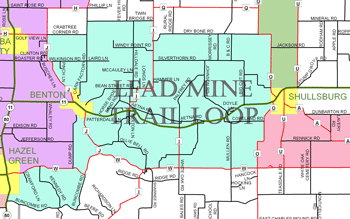
Lead Mine Loop (36 miles)
Parking and Restrooms: Hazel Green, Benton, Shullsburg
The Lead Mine Loop takes you through the heart of Wisconsin’s Lead Mining Region and communities that predate Wisconsin’s statehood. The loop leaves Shullsburg near Badger Park and heads south on County Road O for nearly three miles, 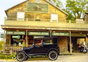 finishing with a big push uphill to County Road W. Take a right and from there it’s a straight shot, mostly downhill, past piles of tailings and on to rustic New Diggings. Three miles past New Diggings, leave County Road W and enjoy a beautiful ride along the Fever River, on Buncombe Road, before heading north into Hazel Green. Hazel Green is the Point of Beginnings for all of Wisconsin. It was here from which every property in Wisconsin was measured. Today, every property deed in Wisconsin includes a description based on the Point of Beginning (POB). The return toward Benton, on County Road W and then Dump Road is a series of moderately challenging hills through rocky terrain and cropland. The loop flattens north of Benton, following County Road J to Crabtree Corner Road. Here you begin the 13 mile trip back to Shullsburg, skirting along the northern edge of the old mining region on a hilly stretch of quiet town roads.
- Map View
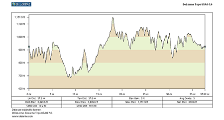
- Topography
- Photos
- Google Map
- Video
View Larger Image (printable)
Lead Mine Loop - 36 miles
View Larger Image (printable)
Coming soon! Select photos from scenic views, vistas, and overlooks throughout each loop.
Coming soon! Google maps of every loop, including markers for views, places of interest, restaurants, and so much more!!
![]()
![]()
Coming soon! Select video from scenic views, vistas, and overlooks throughout each loop.
The following link is to a high-resolution PDF (3 MB file) of the entire Cycle Southwest Wisconsin FREE Bicycle Trail Map. The PDF contains bookmarks that allow you to navigate your way to views of each individual map. Click here to view the map, or right click and chose “save as” to download the PDF.
|