

Home > Bike Loops > Morrey Creek Loop
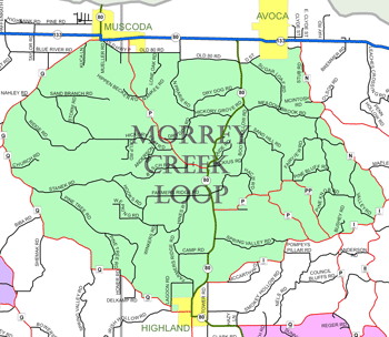
Morrey Creek Loop (38 miles)
Parking and Restrooms: Highland, Avoca, Muscoda
History will fill your thoughts as you ride this loop. You may imagine a Native American sitting on a rock outcropping perched above the Wisconsin River, watching an eagle or hunting turkeys. 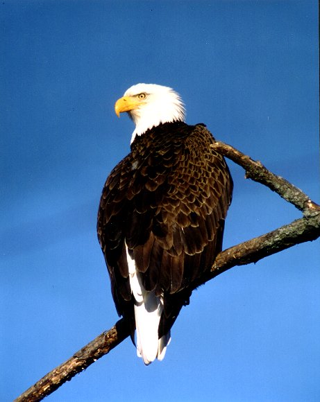 You will face a difficult climb on this route at one time or another, but the views are exceptionally beautiful. The Wisconsin River is wonderful and the bluffs are great. Along the way are reminders of early residents who built settlements in this new world. Two historic little country churches; St Malachi and Fairview are located on County Road I. You can start the Morrey Loop in
  one of three friendly, small communities – Highland, Avoca or Muscoda. Muscoda, the Morel Capital of Wisconsin is a nature lover’s dream come true. Why is Highland called Highland? It’s simple - because it is up High on a ridge. Avoca is home to the largest contiguous prairie east of the Mississippi River.
- Map View
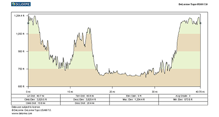
- Topography
- Photos
- Google Map
- Video
View Larger Image (printable)
Morrey Creek Loop - 38 miles
View Larger Image (printable)
Coming soon! Select photos from scenic views, vistas, and overlooks throughout each loop.
Coming soon! Google maps of every loop, including markers for views, places of interest, restaurants, and so much more!!
![]()
![]()
Coming soon! Select video from scenic views, vistas, and overlooks throughout each loop.
The following link is to a high-resolution PDF (3 MB file) of the entire Cycle Southwest Wisconsin FREE Bicycle Trail Map. The PDF contains bookmarks that allow you to navigate your way to views of each individual map. Click here to view the map, or right click and chose “save as” to download the PDF.
|