
Pecatonica Loop (51 miles)
Parking and Restrooms: Darlington, Gratiot, South Wayne, Argyle, Wiota
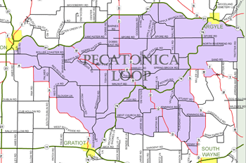
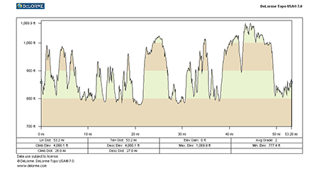
The Pecatonica Loop leaves Darlington and for three plus miles follows along a relatively flat and lightly traveled Hwy. 81. Enjoy this easier stretch, because it’s followed by a long climb up Chadick Hill. Keep going - your reward is at the top - spectacular views in every direction, and eventually a long easy descent into Argyle, boyhood home of Fightin’ Bob LaFollette. Just East of Argyle, the loop moves onto winding tree-lined county roads. The hills here are less challenging, but they come more often, taking you from high scenic  ridges to low areas of crop and wet lands along the Pecatonica River. Follow this 14-mile stretch past Blackhawk Memorial Park, through Woodford. Next on to South Wayne, once known as Lost Township because the original survey was lost on the way to the Land Office. The six miles to Wiota on County Road D is a long steady climb. Turn left on Hwy. 78, and its six more miles to Gratiot, a small community with loads of year-round outdoor recreation. Then down again to the river and ten miles on hilly County Road K that weaves you along the river, and beside wooded hillsides and small Wisconsin farms – a challenging stretch that takes you back to Hwy 23 and downtown Darlington.
- Map View
- Topography
- Photos
- Google Map
- Video

View Larger Image (printable)
Pecatonica Loop - 51 miles

View Larger Image (printable)
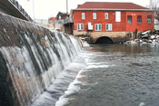
Coming soon! Select photos from scenic views, vistas, and overlooks throughout each loop.

Coming soon! Google maps of every loop, including markers for views, places of interest, restaurants, and so much more!!


Coming soon! Select video from scenic views, vistas, and overlooks throughout each loop.

The following link is to a high-resolution PDF (3 MB file) of the entire Cycle Southwest Wisconsin FREE Bicycle Trail Map. The PDF contains bookmarks that allow you to navigate your way to views of each individual map. Click here to view the map, or right click and chose “save as” to download the PDF.
 Join Email List